

Walks and hikes
Hiking: La Dôle via the Swiss Alps
A long, beautiful hike to a Swiss peak, La Dôle, which offers visitors a 360° panorama, and if they're lucky, the presence of a herd of chamois.
Start : Baraque de Divonne
Road access: By car: from Divonne, follow the signs for the campsite, join the Fleutron, passing the forest house, then climb up to the Baraque de Divonne.
TER line Bellegarde sur Valserine -Divonne les Bains
Signposts: PR-Yellow or Swiss signposts (enamelled sheet metal panels and diamonds), GR-White and Red.
Height difference: 550m
Instructions: bring identity papers, Franco-Swiss itinerary. Contact the Haute chaîne du Jura nature reserve to find out when the forest road is open.
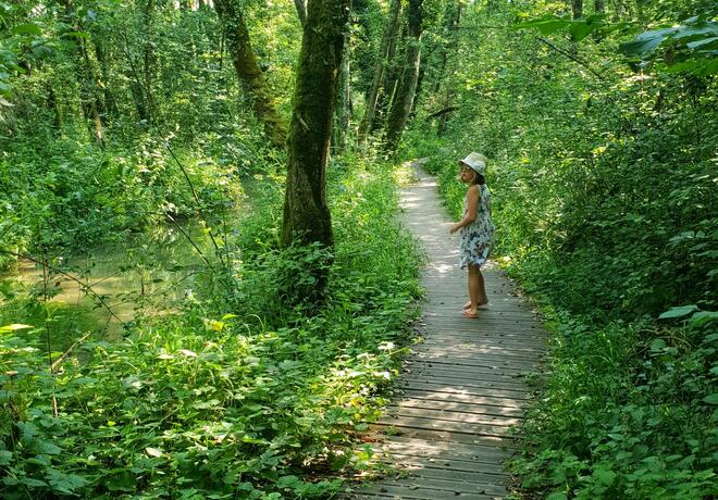
On the way: Swiss mountain pastures, chamois, chalets on the Vattay mountain pastures, high-altitude forest, panoramic views of the Lake Geneva basin and Les Rousses, sub-alpine flora, restored low walls,
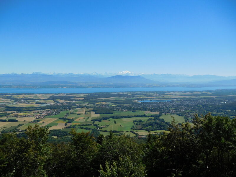
Heritage: Visible from afar from La Dôle, like many Jura (Chasseron, Dent de Vaulion, Mont d'Or, Mont Tendre) and Alpine (Mont Blanc, Aiguille verte, sometimes the Matterhorn) peaks, the Massacre forest was once known as the forêt de la Frasse. When, in the 16th century, the Savoyards attempted to seize Geneva, François 1er, allied with the Bernese, sent a detachment of 1,000 Italian mercenaries to defend it. Travelling up the Valserine, they came up against the army of the Duke of Savoy, who attacked them from the rear and decimated them on the Jura plateau. The forest became and remains known as the Forest of the Massacre.
Did you know it? With an average weight of 400 grams, the wood grouse is Europe's smallest grouse. Its plumage, the color of dead leaves, enables it to blend into the forest environment in which it lives. It prefers undergrowth coppice and beech-fir forests, but also pasture edges and sparse spruce forests. It feeds on shoots and buds, leaves and flowers, seeds, berries and fruit. It lives in pairs and lays 7 to 12 eggs in May-June, which it incubates on the ground, at the mercy of predators. Like the capercaillie, it is a victim of human disturbance and activity, and now benefits from quiet areas.
Route description:
From the Divonne hut, take the forest road in the direction of "Bauloz", then leave it to follow a forest track, cross the border towards the boundary marker, then cross a clearing to reach the Combe du Faoug alpine chalet (Alt.1228m). Cross the alpine pasture road and climb to a fork, leaving the Bauloz sign on the right and following the Dôle sign on the left. Follow the yellow markings as you climb upwards along paths and tracks. Leaving the undergrowth, continue to climb over pastures, and skirting a low stone wall, reach the south-western summit. Follow the yellow and orange markings (mountain path) to reach the summit.
Then retrace your steps and descend to "Petit Sonnailley" (Alt.1390m), cross the border, find the "GR" markings, continue to "Grande Grand" (Alt.1416m) then the "Cabosse" crossroads (Alt.1385m). Leave the GR and take the forest road on the left to the "Col de Combe Blanche" (Alt.1390m), then leave the road to reach the "Petite Grand" on the left (Alt.1400m). Take a downhill path through the "Portail" (Alt.1350m) (Viewpoint indicator at 200m), cross a forest road twice and arrive at the "Baraque de Divonne".
You can also start from "Fleutron" (Alt.620m) or "Cabosse" (Alt.1385m). It is possible to make the round trip to La Dôle from this point (allow 2h30).